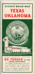
 In the 20th Century, national and international events such as world’s fairs did not have to compete with media. Instead, quite ordinary people saved their pennies and attended the events. The author’s grandfather, for example, attended both the 1904 World’s Fair in St. Louis and the Century of Progress in Chicago. Memorabilia from the latter, 1933-1934, world’s fair and from the 1939-1940 New York World’s Fair is hitting the marketplace as the attendees depart on their eternal road trip. Postcards are the best known mementoes, but road maps and fairground maps appear in surprising numbers.
In addition to the oil companies’ exhibits and publications, state governments also released ‘World’s Fair Edition’ road maps, and pictorial ‘tourist’ maps to capitalize on the events. Some connections seem a bit tenuous, for example, a 1939 Montana road map issued in a World’s Fair edition.
Other American events, some with a very narrow audience, for which the oil companies issued maps include Boy Scout Jamborees (Sunoco, Conoco, and even Atlantic) and American Legion conventions (Shell).
World’s Fairs and other Exhibitions
- Chicago Century of Progress
- Great Lakes Exposition
- Golden Gate Exposition
- Texas Centennial
- New York World’s Fair, 1939-40
- Seattle World’s Fair
- New York World’s Fair, 1964
- Hemisfair ’68
